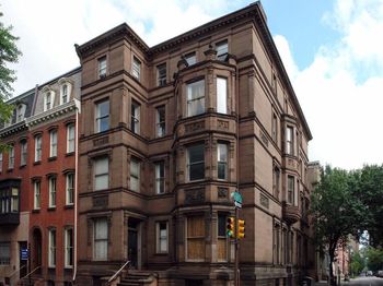
About Rittenhouse Square
Rittenhouse Square is the name of both a public park and the surrounding neighborhood that is referred to also as Rittenhouse in Center City, Philadelphia, Pennsylvania, United States. The park is one of the five original open-space parks planned by William Penn and his surveyor Thomas Holme during the late 17th century.
The neighborhood is among the highest-income urban neighborhoods in the country. Together with Fitler Square, the Rittenhouse neighborhood and the square comprise the Rittenhouse Fitler Historic District.
Rittenhouse Square Park is maintained by the non-profit group, The Friends of Rittenhouse Square. Known as "the Square," the park is widely considered one of the finest urban public spaces in the United States. The square cuts off 19th Street at Walnut Street and also at a half block above Manning Street. Its boundaries are 18th Street to the East, Walnut St. to the north, Rittenhouse Square West (a north-south boundary street), and Rittenhouse Square South (an east-west boundary street), making the park approximately two short blocks on each side.
Read More ▾The Commute
Travel Methods
To City CenterAvailable Properties
View all ⇢Rittenhouse Square Sales Data
Percentage change from latest quarter vs same time period previous year
Data compiled using 4th quarter 2023 data vs. same period from 2022
Median Sales Price
MEDIAN SALES PRICE

Demographics
- Filter by:
- Population
- Income
- Education
- Market Rents
Population by Age Level. Median Age 37.45. Households: 6,696.
In Thousand of Dollars. (Median Income: $103,640)
Population by Education Level
Fair Market Rents
Where To Drink, Dine, Shop, Relax & Recline


